
What Is LiDAR Annotation?
What Is LiDAR Annotation?
LiDAR (Light Detection and Ranging) is a remote sensing technology that uses laser pulses to create 3D
representations of the environment. LiDAR data annotations involve the labeling of objects within the
point cloud data generated by LiDAR sensors.
Use Cases
Use Cases
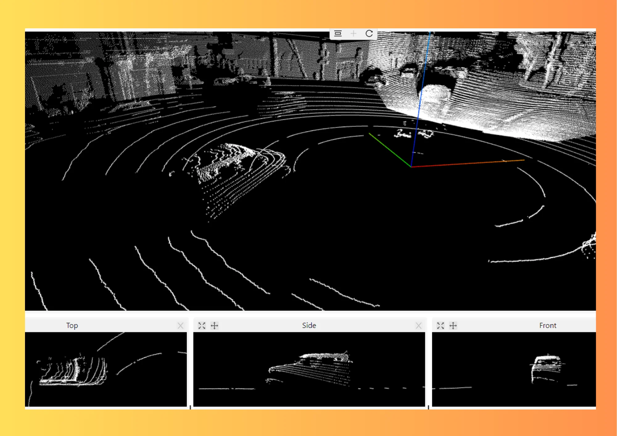
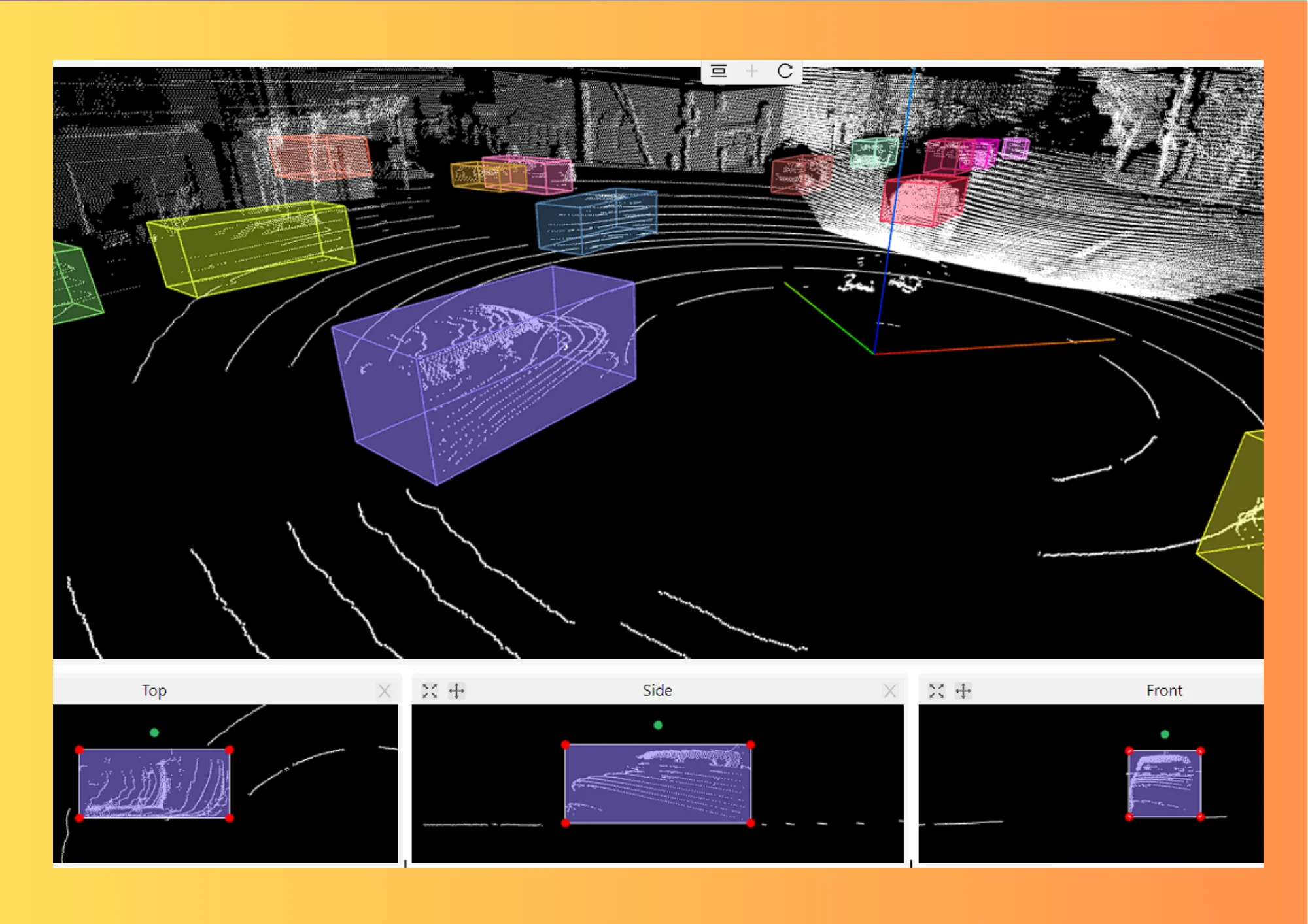
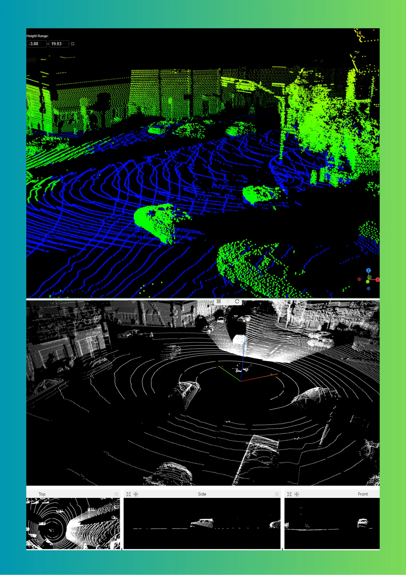
Autonomous Driving
Autonomous Driving
LiDAR data annotation is used to detect and classify objects such as cars, pedestrians, and traffic
signs, which are essential for safe and reliable operation of autonomous vehicles.
.webp)
.webp)
.webp)
Environmental Monitoring
Environmental Monitoring
LiDAR Annotation is used to track changes in the natural environment, such as the growth of forests or
the erosion of coastlines and is used for Conservation, Land Management, and Disaster Response Planning.
Construction and Infrastructure Management
Construction and Infrastructure Management
LiDAR Annotation enables monitoring of construction sites and tracking the progress of construction
projects. They can also be used to inspect and maintain infrastructure such as bridges and roads.
Defense and Security
Defense and Security
LiDAR Annotation is used for military and security applications, to map terrain, detect and track
vehicles and personnel, and monitor borders and perimeters.
Interested?
Interested?
Register now, and take the Aptitude Test!